
Data Services.

ASA provides Australian-based geospatial and engineering data services across multiple industries.
We consistently deliver professional, award-winning, high-quality data services for real-world projects, including telecommunications, energy, conservation, travel and resources. Our team specialises in Geographic Information Systems (GIS), Survey, Computer Aided Design (CAD), Building Information Modelling (BIM), Asset Management and Machine Learning technologies. We also undertake Information Management and Document Control services.
Contact us to find out how we can help with your data management needs so you can ensure data sovereignty and eliminate modern slavery risks, while you help us create social impact from your supply chain. You can also view our Geospatial and Engineering case studies.
Senior Survey Manager | John Holland Group
Our clients:


.png)

Our Solutions and Capabilities
ASA works across the Geospatial and Digital Engineering professions, undertaking:
& mapping
Analysis
on labelling
Creation
& conversion
& QA
Drafting
Processing
processing
As-built Drafting
management
Detection
& conversion
Management
Verification
BIM
Modelling
We work across multiple industries, including:
Find out more in our case studies.
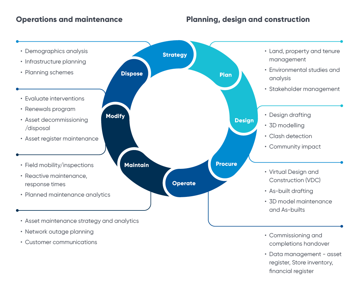
You can engage ASA throughout the entire project lifecycle and multiple touchpoints:
Interested in learning more?
Download our Capability Statements.
How can we support your project?
Geospatial data creation, digitisation, migration and conversion
We provide map feature creation and editing across multiple sectors and software products, including infrastructure, planning, land administration and agriculture. Our data migration and conversion services include translating detailed information from multiple sources into accurate, feature-rich GIS data to enhance management and decision-making. Find out more at our Geospatial case studies.
Digital Engineering drafting and design
We provide 2D and 3D design and As-built services and Building Information Modelling (BIM) using a range of software such as AutoCAD, Civil 3D, Revit and many more, including digital twins, pre-survey calculations, subdivision layout, and conformance reporting, amongst many other services. Find out more at our Digital Engineering case studies.
Data cleansing and quality
The ASA team improves your geospatial and engineering data quality confidence, including analysis, creation and remediation services to support data quality metrics of accuracy, completeness and relevance. These processes can also be scaled to support big data QA/QC sampling and reporting.
Asset data management
ASA brings the geospatial and digital engineering worlds together by integrating engineering drawings and location data. This enhances asset management by providing organisations with a 'single source of truth' for all assets, enabling better maintenance and more efficient and cost-effective delivery.
LiDAR processing and remote sensing
ASA processes, classifies, cleans and models large LiDAR datasets, including aerial, terrestrial and bathymetric data (see our Fugro case study as an example). ASA also delivers support services for various multispectral analysis across all major industries.
Imagery and satellite analysis
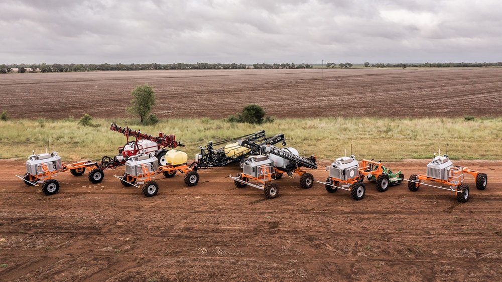
Our team generates spatial attributes by recognising, differentiating and classifying imagery features from aerial photos, satellite images, thermal images, digital elevation models (DEMs), and scanned maps. Applications include paddock mapping, autonomous vehicle tracking, geofencing, farm asset and inventory classification and analysis.
Information Management and Document Control
Our dedicated team provides support to deliver the critical administrative backbone of Australia’s major infrastructure, engineering, and construction projects. ASA analysts are technology-agnostic and proficient in many Common Data Environments and platforms (e.g. Asite, Fulcrum, ClickUp, SharePoint) that serve as the ‘engine room’ of your project team, providing high-integrity information and document support.
Artificial Intelligence and Machine Learning
We provide the people power to create custom training datasets for machine learning algorithms. This includes annotations and segmentation of text and imagery training sets, as well as QA/QC.
Talent services
We provide onshore data services for clients, ensuring data sovereignty is maintained. We can also embed our people within your teams to work on your projects or transition them to vacancies within your organisation to diversify your workforce. Engaging ASA means you will create social impact from your supply chains, while helping your Infrastructure Sustainabilty (IS) Ratings! Find out more at our Talent Services page.
Industry Skills
Geospatial


Digital Engineering


Case Studies


Telco Design and Documentation for NBN developments
The project began with SD2 As-Built jobs, and quickly expanded to include working on BDOD As-Builts for both the Queensland and Victoria/Tasmania divisions of Ventia. The VIC/TAS division in particular had a great deal of backlog, which ASA was able to reduce significantly.
Over 30 staff have been trained on the project in total, with around seven to nine staff between the Melbourne and Brisbane offices working on the project on any given day. Over 5,000 work orders and 26,000 hours have been put towards the project, with ongoing work continuing. In addition to the benefits of engaging with a non-profit social enterprise, Ventia has also benefited due to ASA’s service provision being, on average, 30% faster than comparable providers. Our team has also co-located with Ventia in their Melbourne office.
See more at our Ventia case study.
Senior Project Director | NBN QLD
LiDAR processing and feature extraction
Director - Hydrography and Coastal Resilience | Fugro
Roads and address validation
Manager | Queensland Department of Resources
Merging legacy databases for a unified GIS
Senior Principal Consultant | Digital Strategy Centre of Excellence